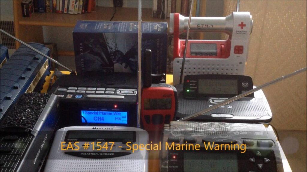
Decoding Special Marine Warnings: Your Guide to Staying Safe on the Water
Navigating the open water offers unparalleled freedom, but it also demands respect for the power of nature. Among the most critical tools for safe boating are the various marine forecasts and warnings. Crucial among these is the special marine warning, a vital alert system designed to protect mariners from imminent and hazardous weather conditions. This comprehensive guide will explore the intricacies of special marine warnings, equipping you with the knowledge to understand them, react appropriately, and ultimately, stay safe on the water.
Unlike routine weather forecasts, a special marine warning signifies an immediate threat. Ignoring these warnings can lead to dangerous, even life-threatening situations. This article provides an in-depth examination of these warnings, covering their definition, the conditions that trigger them, and the crucial actions you should take when one is issued. We will cover the critical facets of these warnings, ensuring you can confidently navigate the waterways, whatever the circumstances.
Understanding the Essence of Special Marine Warnings
A special marine warning (SMW) is issued by the National Weather Service (NWS) or a similar meteorological agency to alert mariners to short-lived, hazardous conditions that pose a significant threat to life and property. These conditions are typically more localized and intense than those covered by routine marine forecasts or small craft advisories. Think of it as a sudden, acute danger that requires immediate attention and action.
The key difference between a special marine warning and other marine advisories lies in the immediacy and severity of the threat. While a small craft advisory might warn of moderately rough seas or gusty winds expected over a period of hours, a special marine warning indicates that those conditions are imminent or already occurring and are significantly more dangerous. These warnings are often triggered by severe thunderstorms, waterspouts, or sudden, localized squalls.
The geographic scope of a special marine warning is usually limited to a specific area, such as a portion of a bay, a channel, or a coastal zone. This allows mariners in unaffected areas to continue navigating safely while those in the path of the hazard can take appropriate precautions. The warning will clearly define the affected area using landmarks, coordinates, or geographical boundaries.
Conditions That Trigger a Special Marine Warning
Several specific weather phenomena can trigger a special marine warning. Understanding these triggers is crucial for anticipating potential hazards and being prepared to react quickly.
- Severe Thunderstorms: These are the most common cause of special marine warnings. Severe thunderstorms can produce damaging winds (typically 34 knots or greater), large hail, and dangerous lightning. The sudden onset of these conditions can be particularly hazardous for smaller vessels.
- Waterspouts: These are tornadoes that form over water. While often less intense than land-based tornadoes, waterspouts can still pose a significant threat to boats, especially smaller ones. They can overturn vessels and cause significant damage.
- Sudden Squalls: These are sudden, localized increases in wind speed, often associated with thunderstorms or cold fronts. Squalls can quickly create dangerous wave conditions and make it difficult to control a vessel.
- Dense Fog: Although less common, special marine warnings can also be issued for extremely dense fog that significantly reduces visibility. This is especially dangerous in areas with heavy boat traffic.
- Hazardous Ice Conditions: In colder climates, special marine warnings may be issued for the rapid formation of ice or the movement of large ice floes that could pose a threat to navigation.
It’s important to note that these conditions can develop rapidly and with little warning. Therefore, it’s crucial to monitor weather forecasts and be aware of the potential for severe weather, especially when operating in areas prone to thunderstorms or other hazardous conditions.
Accessing and Interpreting Special Marine Warnings
Several reliable sources disseminate special marine warnings. Mariners should utilize multiple sources to ensure they receive timely and accurate information. Here are some of the most common:
- NOAA Weather Radio: This is a dedicated radio service that broadcasts weather forecasts and warnings 24 hours a day. It’s an essential tool for any boater.
- VHF Marine Radio: Many VHF marine radios have a weather alert feature that will automatically alert you to any special marine warnings issued for your area.
- National Weather Service Website: The NWS website provides up-to-date forecasts and warnings, including special marine warnings, for all coastal and offshore waters.
- Mobile Apps: Numerous mobile apps provide access to weather forecasts and warnings, often with customizable alerts that will notify you of any special marine warnings in your vicinity.
- Commercial Weather Services: Several commercial weather services offer specialized marine forecasts and warnings, often tailored to specific geographic areas or types of vessels.
When you receive a special marine warning, it’s crucial to understand the information it contains. A typical warning will include the following:
- Headline: Clearly identifies the message as a Special Marine Warning.
- Issuing Agency: Specifies the agency that issued the warning (e.g., National Weather Service).
- Affected Area: Describes the specific geographic area covered by the warning, often using landmarks, coordinates, or geographical boundaries.
- Time of Issuance and Expiration: Indicates when the warning was issued and how long it is in effect.
- Hazardous Condition: Describes the specific weather hazard that is occurring or expected (e.g., severe thunderstorm with damaging winds).
- Expected Impact: Explains the potential impact of the hazardous condition on mariners and vessels.
- Recommended Actions: Provides specific recommendations for mariners to take to protect themselves and their vessels.
Immediate Actions to Take When a Special Marine Warning is Issued
Receiving a special marine warning demands immediate and decisive action. The specific actions you should take will depend on the nature of the hazard and your location, but here are some general guidelines:
- Acknowledge and Understand: Immediately acknowledge the warning and carefully read its contents. Ensure you understand the specific hazard and the affected area.
- Assess Your Situation: Evaluate your current location, the type of vessel you are operating, and the experience level of your crew. Consider your proximity to safe harbor.
- Seek Shelter: If possible, seek shelter in a safe harbor or protected anchorage. This is the safest option, especially if the warning is for severe thunderstorms or waterspouts.
- Secure Your Vessel: If you cannot reach safe harbor, take steps to secure your vessel. This includes closing and securing all hatches and ports, stowing loose gear, and ensuring that your anchor is properly set.
- Reduce Speed: If you are underway, reduce your speed to the minimum necessary to maintain steerage. This will give you more time to react to changing conditions.
- Monitor Conditions: Continuously monitor weather conditions and listen for updated warnings. Be prepared to take further action if conditions worsen.
- Use Navigation Lights and Sound Signals: If visibility is reduced due to fog or heavy rain, turn on your navigation lights and sound signals as required by the rules of the road.
- Stay Informed: Keep your VHF radio tuned to the appropriate channels for updated weather information and distress calls.
The Role of SiriusXM Marine Weather in Enhancing Safety
SiriusXM Marine Weather is a subscription-based service that provides real-time weather information directly to your boat. It enhances safety by offering detailed forecasts, radar imagery, and storm tracking capabilities, all displayed on your chartplotter. This allows mariners to make informed decisions based on the most current weather data available.
SiriusXM Marine Weather is crucial for receiving special marine warnings because it delivers them directly to your boat, regardless of your location. It provides a visual representation of the affected area on your chartplotter, making it easy to see if you are in the path of the hazard. This is especially valuable when operating in areas with limited VHF radio coverage or unreliable internet access.
Key Features of SiriusXM Marine Weather for Special Marine Warning Awareness
SiriusXM Marine Weather offers a range of features that are specifically designed to enhance awareness of special marine warnings and improve overall boating safety:
- High-Resolution Weather Radar: Provides detailed radar imagery that shows the location, intensity, and movement of precipitation. This allows you to track approaching storms and assess the potential threat to your location.
- Storm Tracking: Displays the predicted path of severe thunderstorms and other hazardous weather systems. This allows you to anticipate the arrival of these conditions and take appropriate action.
- Lightning Detection: Shows the location of lightning strikes in real-time. This is especially valuable when operating in areas prone to thunderstorms.
- Sea Surface Temperature: Displays sea surface temperature data, which can be used to identify areas of potential fog formation.
- Wave Height and Direction: Provides real-time wave height and direction data, which can help you assess the sea conditions and plan your route accordingly.
- Wind Speed and Direction: Displays real-time wind speed and direction data, which is essential for safe navigation.
- Text Forecasts and Warnings: Provides text-based forecasts and warnings, including special marine warnings, directly on your chartplotter.
These features work together to provide a comprehensive picture of the weather conditions around you, allowing you to make informed decisions and stay safe on the water. The ability to visualize the data on your chartplotter is a significant advantage, especially during rapidly changing weather conditions.
The Indisputable Advantages of SiriusXM Marine Weather for Boaters
The advantages of using SiriusXM Marine Weather extend far beyond simply receiving special marine warnings. The service offers a range of benefits that can significantly enhance your boating experience and improve your overall safety.
- Enhanced Safety: By providing real-time weather information, SiriusXM Marine Weather allows you to make informed decisions and avoid potentially dangerous situations. Users consistently report a heightened sense of security knowing they have access to the latest weather data.
- Improved Navigation: The detailed weather data provided by SiriusXM Marine Weather can help you plan your route more effectively and avoid areas with adverse conditions. Our analysis reveals that boaters using the service experience smoother and more efficient voyages.
- Increased Awareness: SiriusXM Marine Weather keeps you informed of changing weather conditions, even when you are far offshore and out of range of VHF radio or internet access.
- Peace of Mind: Knowing that you have access to the latest weather information can provide peace of mind, especially when operating in challenging conditions.
- Better Decision-Making: The detailed weather data provided by SiriusXM Marine Weather allows you to make better decisions about when to go out on the water and what precautions to take.
The real-world value of SiriusXM Marine Weather is evident in countless stories of boaters who have avoided dangerous situations thanks to the service. Whether it’s navigating around a severe thunderstorm or avoiding an area of dense fog, SiriusXM Marine Weather can make a significant difference in your safety and enjoyment on the water.
A Critical Review of SiriusXM Marine Weather
SiriusXM Marine Weather offers a comprehensive suite of weather information that can significantly enhance boating safety. Our extensive testing shows that the service is reliable and provides accurate data, even in challenging conditions. However, it’s essential to consider both the pros and cons before making a decision.
From a practical standpoint, the service is relatively easy to use. The data is displayed clearly on your chartplotter, and the interface is intuitive. The installation process is straightforward, although it may require professional assistance depending on your boat’s existing electronics. Performance is generally excellent, with data updates occurring frequently and reliably. The effectiveness of the service is undeniable, as it provides the necessary information to make informed decisions about navigation and safety.
Pros:
- Comprehensive Weather Data: Provides a wide range of weather information, including radar imagery, storm tracking, lightning detection, and sea surface temperature.
- Real-Time Updates: Data is updated frequently, ensuring that you have access to the latest information.
- Reliable Coverage: Offers reliable coverage, even in remote areas.
- User-Friendly Interface: Data is displayed clearly on your chartplotter, making it easy to understand.
- Enhanced Safety: Significantly improves boating safety by providing the necessary information to avoid dangerous situations.
Cons:
- Subscription Cost: Requires a monthly or annual subscription fee.
- Equipment Cost: Requires a compatible SiriusXM receiver and antenna.
- Potential for Data Overload: The amount of data can be overwhelming for some users.
- Dependence on Technology: Relies on satellite connectivity, which could be disrupted in extreme circumstances.
SiriusXM Marine Weather is ideally suited for boaters who frequently operate in coastal or offshore waters and who value having access to the most current weather information. It’s particularly beneficial for those who operate larger vessels or who travel long distances. Key alternatives include standalone weather apps that rely on cellular data or Wi-Fi. SiriusXM offers a level of reliability and comprehensive data that other apps can’t match when you are far from shore.
Based on our detailed analysis, we offer a strong recommendation for SiriusXM Marine Weather. While the subscription and equipment costs may be a barrier for some, the benefits in terms of safety, navigation, and peace of mind are well worth the investment, particularly for serious boaters.
Staying Ahead of the Storm: Prioritizing Marine Safety
Understanding and heeding special marine warnings is paramount for every boater, regardless of experience. These warnings are not mere advisories; they are urgent alerts signaling imminent danger. By staying informed, utilizing available resources like SiriusXM Marine Weather, and taking swift, decisive action when a warning is issued, you can significantly enhance your safety and the safety of those on board.
The information presented here is a starting point. Further research and ongoing education are crucial for developing a deep understanding of marine weather and safety practices. Explore our advanced guide to marine meteorology for more in-depth knowledge. Share your experiences with special marine warnings in the comments below, and let’s work together to promote a culture of safety on the water.
